If you’ve read the previous posts on this blog, you’ll know how much I love a good city map. A map can tell you quite a lot, which is part of the reason I like them so much. When I was reading about place names in Victoria (see ‘I Shall Find It On The Map’ Part 2), I was trying to figure out where the ‘shoaling waters’ of Esquimalt might be: a place named for shallow ocean waves much surely have some shallow waters nearby. I thought the name might refer to the Gorge, a narrow inlet which is quite shallow in places, so I had a look at the area on the map, and in doing so, I came across an island I had never noticed before, Halkett Island, also known as Deadman’s Island. What was this place, with its slightly morbid-sounding name? I had to know! There had to be a story behind this island.
The Victoria coastline includes many little islands and islets like Halkett Island, some visible from shore, others more isolated, some inhabitable, others just little rocky outcrops. This post will focus on three islands in particularly which, in different ways, provide us with an interesting lens through which to view white Victorians’ relationship with other groups, be they indigenous or (non-European) immigrant.
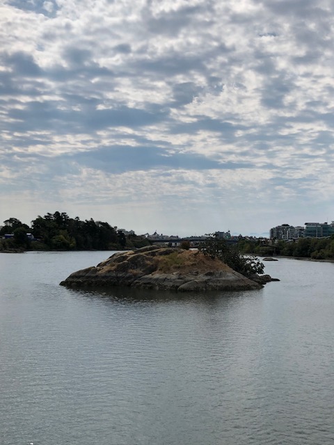
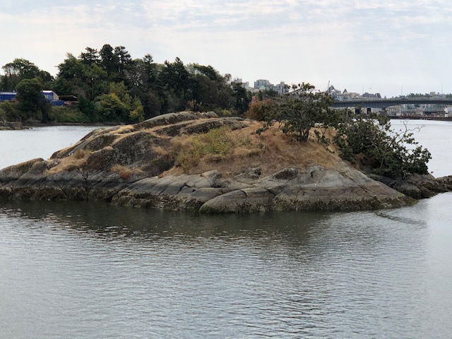
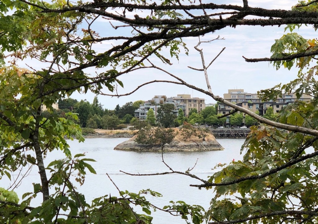
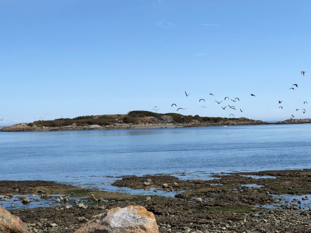
Halkett Island is a small, rocky island in the middle of the Gorge, visible from the Selkirk Trestle which crosses over the Gorge. It is maybe half an acre in size, with a small amount of vegetation growing on it, and it was originally a First Nations burial ground. I had had no idea that this little island, so close to the centre of Victoria, was used for this purpose, or even that using islands as burial sites was fairly common amongst the indigenous people of this part of Canada. When I say burials, I don’t just mean underground burials, although those seem to have been present on Halkett Island; it was common for the Songhees people of this area to opt for above-ground burials, with wooden boxes, containing the body, placed on the ground alongside the belongings of the deceased. Nearby Laurel Point, formerly Deadman’s Point, was used for the same purpose. This little island near the land of shoaling waters clearly had very special significance to the people who traditionally lived here, the Songhees, and the anglicised ‘Deadman’s Island’ name makes more sense.
Enter the early colonists, beginning in 1842. As one would expect, there was often dispute between the indigenous populations and the settlers over who owned the local land, but because settlers did not have much use for little rocky islands like Halkett Island, with no fresh water supply and limited ground on which to build anything, the government tended to be less interested in those islands than in the rest of the area. So at the same time as Victoria was being settled and built upon, mostly by British settlers, the local Songhees people were burying their dead on this island.
On 30 June 1867, however, some local youths headed out to the Island of the Dead and set fire to it.
The newspaper reported it the next day, simply stating that ‘The Indian remains and graves on Deadman’s Island were burned yesterday afternoon, together with the trees and shrubbery thereon’ (The Daily British Colonist, page 3, 1 July 1867. There was, as you may know, some other interesting news that particular day…)
The newspaper for 2 July provides us with a bit more information: the island was used to bury the important men of the tribe, in above-ground coffins, sometimes with wooden images of the deceased, sort of like effigies, from the sounds of it. These were all destroyed in the fire, along with the objects placed with the burials, in this case weapons, canoes, and blankets. The culprit, who had not yet been caught, was condemned as ‘some sacrilegious incendiary’; page 3 of the newspaper describes the fire and its results in quite graphic detail, before declaring that ‘the scoundrel who fired the heap, if discovered, should be well punished’.
There were two such ‘scoundrels’ involved, and both were found and punished. Peter Scully and Sebastian Henry Hebbard were caught (though Hebbard fled and was tracked down several days later) and tried: both were fined, the money going to the Songhees themselves in compensation. They had rowed up to the island and deliberately set it on fire. Even back in this time and place, actually desecrating an indigenous place of burial, deliberately, was considered a step too far. Apparently the authorities were appalled that this should happen in ‘the less turbulent times of ’67’ as even during the wilder years of the Gold Rush in 1858 and 1862, when all manner of people were passing through Victoria, no one had stooped this low.
There was a law in place at the time, known as The Indian Graves Ordinance, which stated that anyone who destroyed or looted indigenous burial sites, or knowingly possessed stolen indigenous grave goods, would be liable for a $100 fine (well over ten times that amount today if you factor in inflation over time) or a three-month prison sentence. Making this law was ‘expedient for the preservation of the public peace’ and, interestingly, it specifically prohibits destruction carried out ‘without the sanction of the government’ (my italics).
Thus the above-ground burials on Deadman’s Island were destroyed in 1867, although the Songhees still seem to have used the island for burials up until the early twentieth century. The island has since been taken out of, and later returned to, the Songhees Reserve. It was disturbed a second time in 1961, when some local young people dug up some of the below-ground burials and took the objects they found. Most of the objects were recovered.
The story of Halkett Island got me looking into some of the other little islands around Victoria.
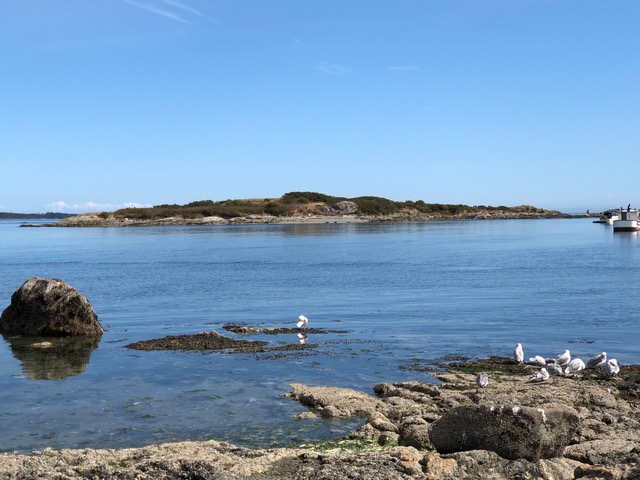
Mary Tod Island is next on our tour. This is a little island in Oak Bay, clearly visible from the shore; a small breakwater has been added to it recently. This island seems to have gone by two different names up until at least the 1960s. It was known as Mary Tod Island after the wife of one of the chief traders of the Hudson’s Bay Company (side note: the Tods’ house, built in 1850, is the oldest continuously occupied house in British Columbia). It was also known as Jimmy Chicken’s Island.
What a name! But who was Jimmy Chicken? There is a lot we do not know about him, but we do know that he was an indigenous man who lived on the island with his wife, Jenny, towards the end of the nineteenth century. Jimmy Chicken’s name for the island was ‘place where there are many fish’, or ‘Kohweechala’. This was how he made his living, by fishing. That, and stealing chickens.
Jimmy and his wife both drank heavily. Jimmy in particular was always in and out of prison for being so drunk, but he doesn’t seem to have been a bad sort; he was often picked up by the police for his own safety, not because he was causing anyone else any trouble. Even according to the police and magistrates who were constantly dealing with him, he was always very friendly and trustworthy; just a good, likeable, soul, it seems. He and his wife seem to have been buried on the Chatham Islands, a bit further out to sea, and he had quite a send-off by the First Nations community at his funeral in 1901, with one hundred canoes accompanying his body out to the Chatham Islands. The Daily Colonist even mentions his death (1 February 1901), though referring to his island as Mary Tod Island.
So now, looking at that little island, I wonder what it would have looked like over a hundred years ago, with a little house on it, inhabited by quite a character.
Moving north to the Saanich Peninsula, and heading a bit further from the coast, we come to D’Arcy Island, a former leper colony.
Victoria tended to be the first entry point into Canada for people arriving via the Pacific Ocean, and William Head, just outside Victoria in Metchosin, was the quarantine station where ships and their passengers were checked for disease and cleared for entry into Canada. After 1858, many people arrived in Victoria from China, and Victoria came to have a substantial Chinese population; Victoria’s Chinatown is in fact the oldest in Canada and the second-oldest in North America.
In 1891, five Chinese men were found hiding, in Chinatown – all five had leprosy. Canada had one leprosarium at this time, over on the east coast; it was properly run and had adequate medical facilities. But instead of sending these five men there to be looked after, the provincial government designated D’Arcy Island as a leper colony on the west coast, and took the men there.
Other people with leprosy were sent to D’Arcy Island between 1891 and 1906, some from Victoria, some from other places like Vancouver, but all, or at least most, of them seem to have been Chinese. The people of Victoria knew this leper colony was there, but did not know much about it. Officials visited the island every three months with supplies, but otherwise those who were sent to the island had to fend for themselves. If you were sent to D’Arcy Island, that was it. One man was apparently rescued from the island by his wife, but otherwise, there was no escaping.
In 1906 the federal government took over managing the island, and conditions started to improve. The leper colony was shut down in 1924 and moved to Bentinck Island, which looked after lepers until 1957: Bentinck Island is just off of William Head, the quarantine station mentioned earlier. D’Arcy Island would later be used by an American bootlegger as a drop-off point for liquor; someone would pick up the liquor from the island and smuggle it into the States. But the people who died on that island were largely forgotten, and the buildings were burned down. You can visit the island now; I think it would be very interesting, but also very sad.
I did not know any of this prior to researching this post. I had a vague knowledge that D’Arcy Island was a leper colony, but I did not know that most of the people sent there were Chinese and that they lived in such terrible conditions. I had never heard of Jimmy Chicken and his interactions with the people of Victoria, and had no idea that there had even been a First Nations burial site in the Gorge, let alone that it was deliberated destroyed by fire and what the official reaction was to its destruction. Because I was curious about a place name and saw an island on the map that I didn’t recognise, I have now learned all of these things.
I want to leave you with some other islands you might see of the coast of Victoria, plus one you probably won’t…
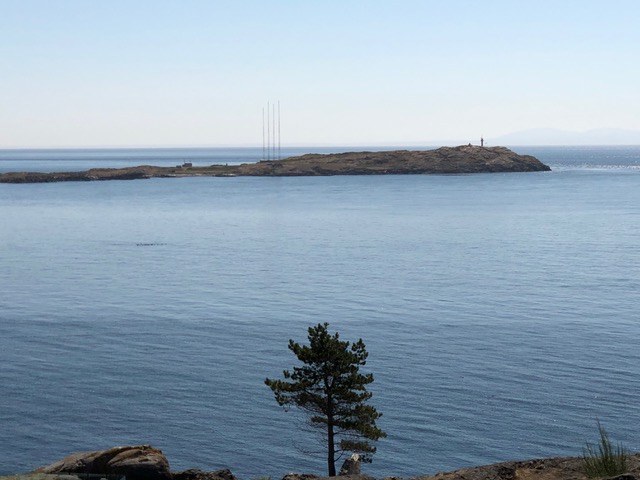
If you are walking along Dallas Road between Victoria and Oak Bay (as I do, every New Year’s Day), you will see a rocky island with four antennae on it. This is Trial Island. There are two theories for this name: that ships would do a ‘trial run’ around the island, or that it was a trial to sail through the strong currents surrounding this island. Trial Island had a lighthouse keeper up until a few years ago, and those antennae you see today are for the local radio station.
Cole Island, between Esquimalt and Colwood, was an ammunition depot for the Royal Navy, and you can still see many of the Navy buildings still standing. According to the Historic Sites and Monuments Board of Canada, it is ‘the most complete site’ of Royal Naval activity and infrastructure in the Commonwealth’, and it’s on my list of places to visit.
Finally, the Chatham Islands, where Jimmy Chicken and his wife were buried. This is actually a small group of islands which are part of the Songhees Territory, and you can’t actually visit them. The island were in fact inhabited by some of the Songhees people until the well on the island dried up in 1957. Their name for the islands is ‘Tlchess’, or ‘T’ches’, meaning ‘one island’, because at low tide they are connected.
Further Reading
Victoria’s first newspaper, the forerunner of the present Times Colonist, is readable and searchable from 1858-1980, and it is fascinating. Zoom right in though, because the newspaper print is very tiny! http://www.britishcolonist.ca/dateList.php
For the full text of The Indian Graves Ordinance, 1867, see https://open.library.ubc.ca/collections/bchistoricaldocuments/bcdocs/items/1.0370745#p0z-3r0f:
For a more detailed account of the life of Jimmy Chicken: https://www.timescolonist.com/life/tales-from-the-vault-the-island-of-jimmy-chicken-1.15004
